English| EUR
Suggested for you
More currencies
Choose a language
Sardinia's 1,850 kilometers of coastline hide more than a hundred documented snorkeling sites, from shallow Posidonia meadows to granite boulder fields that drop into the Mediterranean blue. Each coast offers a different underwater landscape. This guide maps the named bays, reserve boundaries and public access points that turn a shoreline into a dive plan.
Quick answer
A Sardinia snorkeling map divides the island into four coastal zones: the northeast Costa Smeralda and La Maddalena archipelago for granite formations and protected coves, the east Gulf of Orosei for deep-water clarity and marine reserves, the south from Villasimius to Chia for accessible sand-entry sites, and the west Sinis Peninsula for Posidonia seagrass meadows. Most named sites are free-access public beaches. Marine reserves require advance online registration but charge no entrance fee.
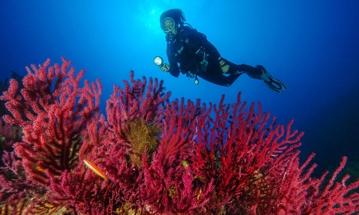
Sardinia sits in the center of the western Mediterranean with water clarity that rivals the Aegean, yet its snorkeling geography remains poorly indexed outside Italian-language forums. A sardinia snorkeling map solves a practical problem: the island's best underwater sites carry no roadside markers, and many require dirt-track navigation or boat transfer to reach the entry point. The northeast holds the highest density of named sites. Cala Coticcio in the La Maddalena archipelago offers turquoise shallows over white sand, with granite boulders creating swim-throughs at three to six meters. Caprera's Cala Portese provides shore access to a sloping reef where damselfish and wrasse cluster around Posidonia beds. The Costa Smeralda shoreline between Porto Cervo and Golfo Aranci contains two dozen named coves, most reachable by paved road and marked parking. These sites handle the highest visitor volume and show the most boat traffic during July and August. The east coast's Gulf of Orosei holds Sardinia's deepest-water snorkeling. Cala Goloritzé and Cala Mariolu require either a three-hour hike or a paid shuttle boat from Cala Gonone, but their underwater visibility reaches thirty meters on calm mornings. The Tavolara-Punta Coda Cavallo marine reserve, straddling the northeast-east transition, enforces no-anchoring zones but allows free swimming. Grouper and octopus sightings are common along the reserve's southern boundary near Molara Island. The south coast from Villasimius to Chia offers the easiest beach access and the warmest water. Punta Molentis and Spiaggia del Riso provide gentle sand entry with rocky outcrops at fifty meters offshore, suitable for beginners. Capo Carbonara marine reserve, adjacent to Villasimius, permits snorkeling in designated zones marked by yellow buoys. The west Sinis Peninsula, anchored by the Mal di Ventre marine reserve, showcases the Mediterranean's densest Posidonia oceanica meadows. Is Arutas beach serves as the primary access point, with the seagrass beginning ten meters from shore. Underwater topography varies by geology. Granite coasts produce boulder fields and caves. Limestone sections create vertical walls and arches. Sedimentary stretches offer gradual slopes with sand channels between reef patches. A functional snorkeling map of Sardinia marks not just the beach name but the substrate type, depth range and whether the site requires a boat or permits shore entry.
“Sardinia's best underwater sites carry no roadside markers, and many require dirt-track navigation or boat transfer to reach the entry point.”
The best arrival window for using a Sardinia snorkeling map is 08:00–11:00, which offers calm, clear water and minimal crowds. Planning your visit during the shoulder seasons ensures better visibility and reduced beach traffic.
Warm waters 22–26°C; frequent sunshine
Peak season offers the warmest temperatures for extended snorkeling sessions.
Mild waters 19–21°C; pleasant climate
These months provide clear visibility and quieter conditions at popular coastal sites.
—
Arriving during the 08:00–11:00 window avoids mid-day crowds and ensures the calmest sea conditions.
Verdict: For the quietest experience and best water clarity, plan your visit for weekday mornings between 08:00–11:00 during the months of May or October.
Access to public beaches and snorkeling locations across Sardinia is free of charge. Costs for snorkeling activities depend entirely on whether you bring your own equipment or choose to rent gear from local vendors.
Verdict: A typical visitor pays 0 EUR for access, with costs only incurred if renting gear or booking private excursion services.
Public coastal sites featured on the Sardinia snorkeling map remain accessible to visitors at all times throughout the week.
Sardinia is located in the Mediterranean Sea, and reaching snorkeling sites effectively requires a mix of road travel and maritime access. Renting a car is essential for exploring hidden coastal coves that are not accessible via public transportation.
SS131 and SP roads to coastal access points
Private or group charters from major ports
ARST regional bus lines to main towns
Plan to arrive between 08:00–11:00 to avoid mid-day crowds and ensure optimal water conditions. Utilizing a rental car provides the flexibility needed to reach remote spots identified on the snorkeling map.
Prepare your snorkeling equipment and understand Sardinia's coastal conditions before heading out.
Everything you need to know about sardinia snorkeling map
You can find various digital and printed resources to navigate local waters, though no single official sardinia snorkeling map exists for every cove. Relying on verified local guides helps identify accessible entry points along the island's extensive coastline.
Using a visual Sardinia underwater guide allows you to correlate specific rock formations with marine diversity. These tools help identify sheltered bays where visibility is typically high for observing Mediterranean fish species.
Entrance fee is 0 EUR as there is free entry to public beaches and snorkeling sites. You do not need to pay for access to these natural coastal environments.
The best arrival window is 08:00–11:00 to avoid mid-day crowds and enjoy calm, clear water conditions. Visiting during these hours ensures the best light for underwater photography and minimal surface chop.
Since public beaches and coves are open to everyone, you do not need to book in advance to use a sardinia snorkeling map. Simply plan your route based on local weather and sea conditions for the day.
A Sardinia marine life chart provides context for the biodiversity found in seagrass meadows and rocky reefs. It helps you identify local species like grouper or sea bream while you are in the water.
When using a sardinia snorkeling map, carry high-quality fins, a mask, and a snorkel to ensure comfort. Always check local marine park regulations regarding protected areas before starting your excursion.
Best Snorkeling Spots in Sardinia
Read more GuideIs It Safe? Sharks in Sardinia
Read more GuideIs Sardinia Worth Visiting?
Read more GuideTop Snorkeling Beaches in Sardinia
Read more Tickets & toursSardinia Snorkeling Tours & Boat Trips
Read more Tickets & toursCagliari Snorkeling Tours
Read more Tickets & toursPalau & North Sardinia Snorkeling
Read more